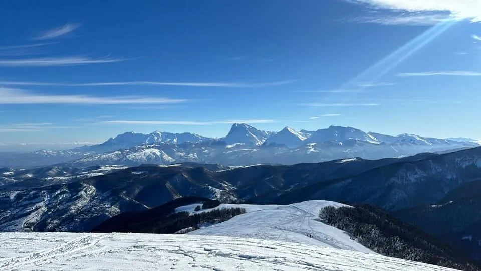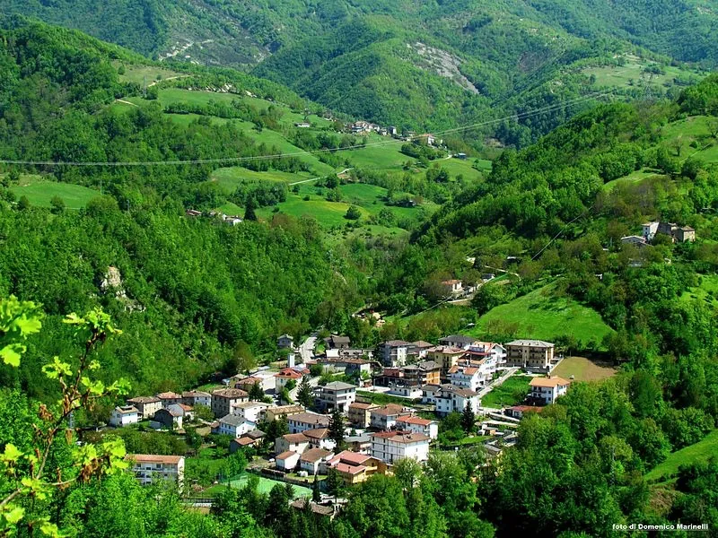
Mountain ridges and forests above Valle Castellana in the Monti della Laga
    Valle Castellana · Monti della Laga

    Hiking, trekking and off-road riding
    in the wildest corner of Abruzzo

    Abandoned stone villages, waterfalls fed by snowmelt, rivers cold enough to swim in August and chestnut woods full of porcini in autumn. Eighteen waymarked itineraries start within minutes of our mountain houses.

    THE VALLEY

    Three ways to explore Valle Castellana

    On foot, on two wheels, or with a basket and a swimming costume. The Laga gives you all three within the same few valleys.

    The Monti della Laga on footHIKING & TREKKING

    HIKING & TREKKING

    The Monti della Laga on foot

    Valle Castellana sits inside the Gran Sasso and Monti della Laga National Park, where sandstone ridges hold water all year and the valleys are green long after the rest of Abruzzo has burned dry. Eighteen waymarked itineraries leave from the hamlets around our houses — abandoned stone villages, hermitages carved into caves, and the highest waterfalls of the Apennines.

    Terrain:
    Beech and chestnut woods, sandstone crests, stream crossings and old mule tracks.
    Waymarking:
    White-and-red CAI blazes on almost every route, with numbered trail signs.
    From the door:
    Most trailheads are a 5–20 minute drive from our mountain houses.

    Don't miss

    • Castel Manfrino — a Swabian castle above the Salinello gorges
    • Laturo and Vallepezzata — abandoned villages reachable only on foot
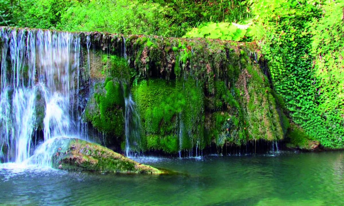
    • Cascata della Morricana — the classic waterfall walk of the Laga
    Gravel and mountain biking the old forest roadsOFF-ROAD CYCLING

    OFF-ROAD CYCLING

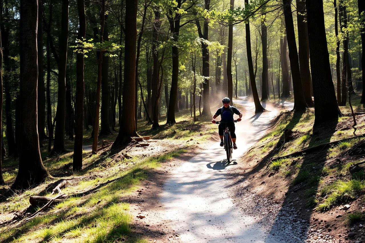
    Gravel and mountain biking the old forest roads

    Forestry tracks (carrarecce and brecciate) link the hamlets on both sides of the valley, and several CAI itineraries are explicitly rideable. It is proper off-road riding: loose gravel, stream fords and long climbs, rewarded by empty tracks and shade for almost the whole day.

    Bike:
    Mountain bike or a rugged gravel setup with wide tyres; e-MTB is a real help on the climbs.
    Best rideable routes:
    Pascellata–Vallefara–Coronelle, Coronelle–Vallepezzata, and the Vallecchia–Lepora loop.
    Storage:
    Secure indoor bike storage and a hose at the mountain houses.

    Don't miss

    • Pascellata to Coronelle — shaded chestnut gravel, rideable both ways
    • Coronelle to Vallepezzata — the tough MTB ring from Pascellata
    • Vallecchia to Lepora — 20 km through the Rio valley
    Mushrooms, chestnuts and river poolsWILD RIVERS & FORAGING

    WILD RIVERS & FORAGING

    Mushrooms, chestnuts and river pools

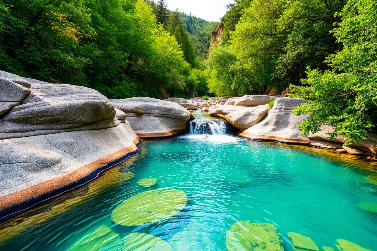
    The Laga is sandstone, so water runs everywhere: the Castellano and Salinello rivers carve clear pools between smooth rock slabs, ice-cold and swimmable through high summer. In autumn the same woods turn into one of the richest foraging grounds in central Italy.

    Bathing:
    Natural pools along the Rio Castellano and in the Salinello gorges. No lifeguards — check depth and current before entering.
    Mushrooms:
    Porcini and other boletes from late August to November after rain. A regional permit is required to pick.
    Chestnuts:
    October harvest in the centuries-old groves above Morrice and Pascellata.

    Don't miss

    • Rio Castellano pools below Font'Amore
    • Salinello gorge pools under Castel Manfrino
    • Piantone di Nardò — a 500-year-old chestnut with a 17 m girth
    THE ITINERARIES

    18 waymarked routes from the hamlets of the valley

    The official itineraries published by the Comune di Valle Castellana, with distance, walking time, height gain and the season each one suits best. Difficulty follows the Italian CAI scale: T (tourist), E (hiking), EE (expert hikers).

    1 · Pascellata to CoronelleEasy

    Pascellata

    1 · Pascellata to Coronelle

    Distance
    6 km (return)
    Duration
    3 hrs
    Elevation gain
    100 m
    Difficulty
    Easy

    CAI trail 445 — woodland path and gravel track, rideable by bike

    • Descent into the Tèvera and Vallefara valleys
    • Gravel track through old chestnut groves
    • Abandoned hamlets of Vallefara and Coronelle

    Almost entirely in the woods, so pleasant even on hot days. Reopened by CAI volunteers; the Vallefara–Coronelle section is rideable on a mountain bike.

    2 · Coronelle to VallepezzataModerate

    Coronelle

    2 · Coronelle to Vallepezzata

    Distance
    7 km (return)
    Duration
    4 hrs
    Elevation gain
    200 m
    Difficulty
    Moderate

    CAI trails 445/446 — beech woods, stream fords, rideable by MTB

    • Beech forest, gullies and small waterfalls
    • Vallepezzata, abandoned for over fifty years
    • Church lintel still carved with the date 1519

    Can be linked with route 1 for a demanding Pascellata ring (mountain bike recommended). Explore the ruins with care — buildings can collapse.

    3 · Casa CAI to VallepezzataModerate

    Leofara

    3 · Casa CAI to Vallepezzata

    Distance
    8 km (return)
    Duration
    4 hrs
    Elevation gain
    500 m
    Difficulty
    Moderate

    CAI trails 442/446 — gravel road then panoramic ridge path

    • Broad crest of Monte Ciccone
    • Views over the Laga and the Sibillini
    • Descent into Vallepezzata from above

    Exposed on the crest — best in spring and autumn. Good fitness required; the return is all uphill.

    4 · Casa CAI to the Grotta della PauraEasy

    Leofara

    4 · Casa CAI to the Grotta della Paura

    Distance
    9 km (return)
    Duration
    4 hrs
    Elevation gain
    150 m
    Difficulty
    Easy

    CAI trail 451 — gravel road with a short rough finish

    • Monte Tignoso and the Cordella spring
    • Wide views over the Laga and Sibillini ranges
    • A rare sandstone cave at the end

    Family-friendly and long but gentle; good all year below the snowline. Entering the cave itself needs caving experience or a qualified guide.

    5 · Leofara to LaturoModerate

    Leofara

    5 · Leofara to Laturo

    Distance
    10 km (return)
    Duration
    5 hrs
    Elevation gain
    200 m
    Difficulty
    Moderate

    CAI trail 452 — traversing mountain path, several stream crossings

    • Ruins of Casale Sabatini
    • Laturo, abandoned in the 1970s and lovingly restored
    • Chapel, fountain and stone lanes cared for by volunteers

    Superb in late spring and autumn. Can be returned via trail 451 past the Grotta della Paura for a longer loop.

    6 · Croce di Corano to Sant'Angelo in VolturinoModerate

    San Vito

    6 · Croce di Corano to Sant'Angelo in Volturino

    Distance
    5 km (return)
    Duration
    3 hrs
    Elevation gain
    400 m
    Difficulty
    Moderate

    Unwaymarked forest track and exposed traverse — experience required

    • Ancient hermitage documented since 1234
    • Wild corner of the Montagna dei Fiori
    • Views down to the Salinello gorges

    Short but the final traverse runs above the climbing crag — dry conditions and a head for heights required. Signposting is still being installed.

    7 · Macchia da Sole to the Santa Maria Maddalena hermitageChallenging

    Macchia da Sole

    7 · Macchia da Sole to the Santa Maria Maddalena hermitage

    Distance
    10 km (return)
    Duration
    6 hrs
    Elevation gain
    300 m
    Difficulty
    Challenging

    CAI trails 413/411d — steep woodland paths, EE grade

    • Hermitage built inside a cave
    • Traces of a frescoed barrel vault and a rainwater cistern
    • The most isolated corner of the Monti Gemelli

    Spring and autumn. EE grade — sure-footedness required. A car shuttle allows a fine traverse to Ripe di Civitella.

    8 · Osso Caprino to the ForchettaChallenging

    Osso Caprino

    8 · Osso Caprino to the Forchetta

    Distance
    10 km (return)
    Duration
    6 hrs
    Elevation gain
    300 m
    Difficulty
    Challenging

    CAI trail 426 — rough, broken cart track

    • Spring water at the parking area
    • The Forchetta pass into the Valle degli Scoiattoli
    • Junction point for the Foltrone circuits

    Best April–October. A longer ring is possible via Piano Maggiore and Macchia da Borea (trail 427).

    9 · Osso Caprino to Monte FoltroneChallenging

    Osso Caprino

    9 · Osso Caprino to Monte Foltrone

    Distance
    9 km (return)
    Duration
    7 hrs
    Elevation gain
    850 m
    Difficulty
    Challenging

    CAI trails 426/426a — steep, loose in places, EE grade

    • Wild north face of the Foltrone
    • Summit ridge with the best panorama in the valley
    • Recommended as a loop: up the 426a, down the 426

    The hardest day here — excellent fitness needed. Avoid in wet conditions: the direct descent is steep and slippery.

    10 · Macchia da Sole to Castel ManfrinoEasy

    Macchia da Sole

    10 · Macchia da Sole to Castel Manfrino

    Distance
    4 km (return)
    Duration
    2 hrs
    Elevation gain
    50 m
    Difficulty
    Easy

    CAI trails 411/411c — easy path, T grade

    • Swabian castle above the Salinello gorges
    • Listed among Abruzzo's key castles in 1269
    • Grassy knoll with a bench and gorge views

    Doable all year and the best short walk for families. Combine with a swim in the Salinello pools in summer.

    11 · Ceppo to the Morricana waterfallModerate

    Ceppo

    11 · Ceppo to the Morricana waterfall

    Distance
    15 km (return)
    Duration
    8 hrs
    Elevation gain
    300 m
    Difficulty
    Moderate

    CAI trail 333 — 6 km forest track then a muddy, obstructed path

    • Start at Ceppo, 1,334 m, in the Bosco Martese
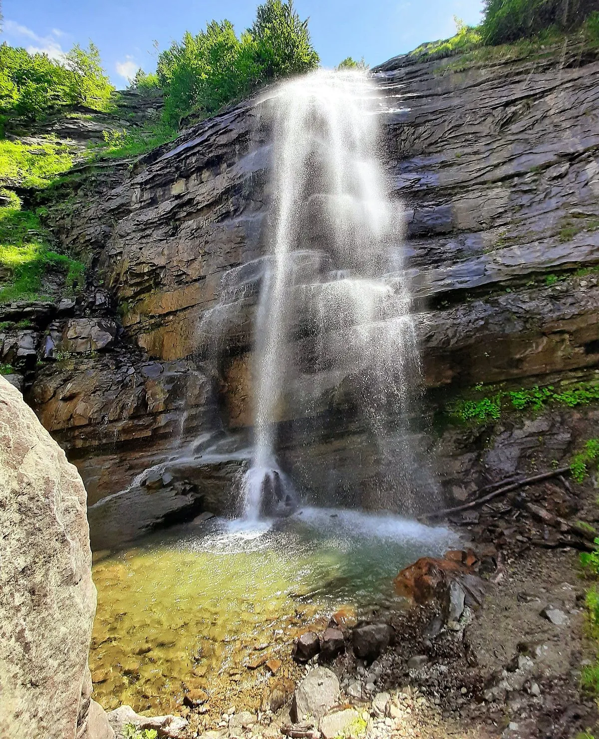
    • The most spectacular waterfall of the Laga
    • Stream bed at 1,600 m below the main drop

    Go in spring, when snowmelt makes the falls dramatic. A long day — start early and expect fallen trees and mud after rain.

    12 · Colle Pietralta to the Cascata ReginaChallenging

    Pietralta

    12 · Colle Pietralta to the Cascata Regina

    Distance
    17 km (return)
    Duration
    10 hrs
    Elevation gain
    700 m
    Difficulty
    Challenging

    CAI trail 325 — forest road to Piana Cavalieri, then mountain path

    • Font'Amore and the Rio Castellano cascades
    • Centuries-old beech forest
    • The heart of the Laga at Piana Cavalieri, 1,350 m

    A full mountain day, spring to early autumn only. A toll road from Collefrattale shortens the approach to Font'Amore (ticket from the bar in Valle Castellana).

    13 · Morrice to the Piantone di NardòEasy

    Morrice

    13 · Morrice to the Piantone di Nardò

    Distance
    1 km (return)
    Duration
    30 min
    Elevation gain
    100 m
    Difficulty
    Easy

    'Sentiero Natura' 320 — short mule track with one steep section

    • A 500-year-old chestnut, 17 m in girth
    • Dozens of centuries-old chestnut patriarchs
    • Crosses the famous Sentiero Italia

    The easiest walk in the valley and the best of the chestnut woods — magnificent in October during the harvest.

    14 · Laturo to ValzoEasy

    Laturo

    14 · Laturo to Valzo

    Distance
    2.3 km
    Duration
    1 hr
    Elevation gain
    138 m up / 119 m down
    Difficulty
    Easy

    Path between hamlets — GPX track published by the Comune

    • Short link between two abandoned villages
    • Quiet woodland walking
    • Good add-on to the Leofara–Laturo day

    Short and manageable in most seasons; combine with route 5 for a full day out of Leofara.

    15 · Laturo to Fosso di OlmetoModerate

    Laturo

    15 · Laturo to Fosso di Olmeto

    Distance
    2.2 km
    Duration
    5 hrs
    Elevation gain
    107 m up / 180 m down
    Difficulty
    Moderate

    Rough valley path down to the stream — GPX track published

    • Descent into the Olmeto gully
    • Running water and deep shade
    • Wild, little-travelled ground

    Slow going despite the short distance. Avoid after heavy rain when the stream bed is high.

    16 · Laturo to San VitoModerate

    Laturo

    16 · Laturo to San Vito

    Distance
    2.2 km
    Duration
    5 hrs
    Elevation gain
    459 m up / 316 m down
    Difficulty
    Moderate

    Steep connecting path — GPX track published

    • Big climb for a short distance
    • Links the Laturo basin with San Vito
    • Views back over the valley as you gain height

    Steep and demanding for its length. Best in cool, dry conditions; carry plenty of water.

    17 · Laturo to LeofaraModerate

    Laturo

    17 · Laturo to Leofara

    Distance
    11.2 km (return)
    Duration
    1 hr sections
    Elevation gain
    552 m up / 549 m down
    Difficulty
    Moderate

    Leofara–Sabatini–Laturo–Cordella ring — GPX track published

    • The classic ring of the Leofara basin
    • Casale Sabatini ruins and the Cordella spring
    • Returns to the start without retracing

    A satisfying full circuit; spring and autumn are ideal. Snow can linger on the higher section into April.

    18 · Vallecchia to LeporaChallenging

    Vallecchia

    18 · Vallecchia to Lepora

    Distance
    20 km
    Duration
    4 hrs
    Elevation gain
    up to 1,200 m
    Difficulty
    Challenging

    Trail 17/b — path with a river ford, long and remote

    • The green Valle del Rio
    • Ford across the torrent
    • Lepora, built in tiers on a sandstone slab

    Graded difficult and long. Cross the ford only when the water is low — avoid after heavy rain or during snowmelt.

    These are mountain routes: walk them with the necessary hiking experience or with qualified guides (CAI, Alpine Guides, Middle Mountain Leaders, AIGAE). The map previews show the general line between hamlets, not the exact trail — follow the white-and-red CAI waymarks on the ground. Route data: Comune di Valle Castellana.

    THROUGH THE YEAR

    When to come, and what for

    Waterfalls in spring, rivers in summer, mushrooms and chestnuts in autumn, and firelight in winter.

    Spring (April–June)

    Snowmelt makes the Laga waterfalls at their most spectacular — the season for Morricana and Cascata Regina. Wild flowers on the ridges, cool walking temperatures, and rivers running high and fast.

    Summer (July–August)

    Almost every trail runs through beech and chestnut shade, so walking stays comfortable. This is the river season: the pools on the Castellano and in the Salinello gorges are cold, clear and swimmable.

    Autumn (September–November)

    Porcini after the first rains, chestnuts in October, and the beech woods turning copper. The best light of the year and the quietest trails. Bring a permit if you plan to pick mushrooms.

    Winter (December–March)

    Snow above 1,000 m; the higher itineraries need winter experience and equipment. Low-level walks around the hamlets stay open, and the wood-burning stove does the rest.

    GOOD TO KNOW

    Before you set off

    A few practical notes for walking, riding and foraging in the Laga.

    A base inside the park

    Our two stone houses in Valle Castellana sit right at the trailheads, with a fireplace, drying space for wet kit and mountain silence at night.

    Waymarked CAI network

    Eighteen official itineraries published by the Comune di Valle Castellana, most with white-and-red CAI blazes and numbered trail signs.

    Go with a guide

    Several routes are remote and rough. CAI, Alpine Guides, Middle Mountain Leaders and AIGAE guides can accompany you — we can point you to local contacts.

    Come prepared

    Trekking boots, waterproof jacket, poles, a full water bottle and dry clothes left in the car. Phone signal disappears in the deeper valleys.

    VOICES FROM THE VALLEY

    What guests say

    People who walked, rode and foraged here, in their own words.

    "We walked to Laturo on the second morning and did not meet a single person. An abandoned village, a restored chapel, and the whole valley to ourselves — then a swim in the river on the way back."

    Walking guest

    Walking guest

    Guest, Netherlands

    "October here is the reason to come. Chestnuts underfoot, porcini in the beech woods, and the forest tracks perfect for the mountain bike once the summer dust has settled."

    Autumn guest

    Autumn guest

    Guest, Italy

    Make the Laga your base camp

    Two stone houses in Valle Castellana — a mountain lodge with a fireplace and a tiny tower for two. Trailheads at the door, and the coast an hour away when you want a change of scenery.